#

#
Land Central Station
A vision to simplify the way Victorian councils integrate their property information into Victoria's statewide map
#
Vision
We at Pozi want to improve the efficiency of Victoria's property and address data maintenance process.
We have a plan to eliminate the friction between the councils and the Victorian state government when exchanging critical property information.
#
Background
Victoria's 79 councils maintain the source of truth for much of the state's property information.

The Victorian Department of Energy, Environment and Climate Action (DEECA) relies on this information for its Vicmap Address and Property datasets. However, the current data exchange process puts responsibility on under-resourced councils to frequently prepare and submit lists of property data updates via complex spreadsheets (M1s).
#
Problem
The current system requires from councils:
- specialised knowledge (typically GIS staff) - even though councils maintain their property data in dedicated property systems, the preparation of M1s requires extensive knowledge of the Vicmap data model and M1 rules
- antiquated workflows (tracking changes, filling in spreadsheets, uploading files)
- valuable staff resources (time better spent on serving the council's own needs)
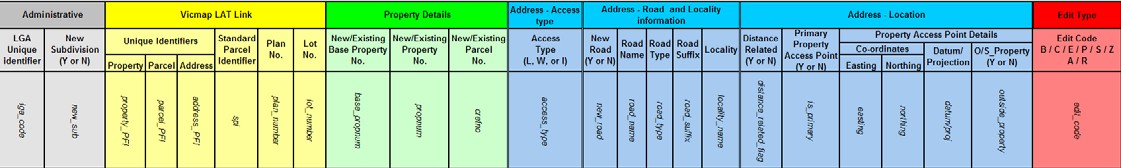
The exchange is made complicated because of the M1 specification:
- must include only the records that have changed
- must add information that the council doesn't maintain
- PFI numbers
- various flags (outside property, new road, multi-assessment, etc)
- edit codes (to instruct DEECA how to update the data)
- manual submission process to VES
- councils receive feedback once a year about how well they're doing
The current system is difficult to automate and innovate upon.
#
Why Does It Matter?
#
For Councils

- councils spend significant time on compiling and supplying data to DEECA that would be better spent on serving the council's own needs
- as staff change or go on leave, there's a breakdown in the process, and it may be weeks or months between critical data updates
#
For DEECA
- data quality varies across the state according to how well resourced individual councils are
- inherent data quality issues - data gridlocks where DEECA can't update Vicmap to reflect the council's version because there is no suitable M1 edit code (eg, changing multi-parcel multi-assessments)
- it's currently impractical for DEECA to innovate within the M1 system because it would require changing the M1 specification/edit codes and re-educating 79 councils
#
Solution
Land Central Station is our concept of a centralised data clearinghouse of property information from all Victorian councils.

It is designed to:
- reduce the friction of data exchange between councils and DEECA
- eliminate ongoing data discrepancies between councils and DEECA
- automate property data maintenance to better suit a modern digital cadastre
#
How It Works
property and address data is synchronised from each council's property system to a central web platform
the platform automatically processes and compiles the data into a single uniform property dataset
DEECA fetches the combined data from the platform on demand in the format of their choosing (complete extract, diffs, M1s, PIQAs, filtered extracts, audits, discrepancy reports, etc)
With DEECA having complete access to the combined authoritative property information from every council, they have all the information they need to update Vicmap.
#
Components
The system comprises:
- a central cloud platform
- a data sync tool installed at each council
#
Cloud Platform
A secure cloud-hosted platform provides a centralised source of truth for property information from every Victorian council.

- API for syncing data from councils
- automated workflows for transforming, validating and combining datasets from multiple councils
- dashboard to provide status of recent loads, match stats, data discrepancy reports, etc
- interactive web map for performing any manual spatial adjustments such as rural addresses and custom property boundaries
- API for DEECA to access the council property dataset
#
Local File Sync

On the council side, a simple data sync tool is installed at each council and configured for their property system to generate and upload a nightly extract of relevant property information.
Alternatively, councils may choose to set up FME, PowerShell or any other tool of their choice to push their data to the cloud platform.
#
Benefits
#
For Councils

- reduce complexity and the need for specialised knowledge within councils
- reduce burden on council resources
- increase frequency of updates
- improve data quality by avoiding data gridlocks
#
For DEECA
- replacing 79 points of contact with a single source of truth for authoritative council property data for the whole state
- reduce risk of councils falling behind in providing updates
- potential to increase data update frequency
- council data can be audited constantly, instead of once a year
- replace expensive and outdated workflow for loading changes
- improve relationships with councils by reducing their burden
- show leadership in government by adopting modern technologies
#
Our Expertise
Pozi is uniquely placed to develop this platform.
We've worked with every council in Victoria (through M1 and PIQA projects), building custom property data integrations into 79 different property data schemas, across seven different vendor systems, on a range of database and web platforms.
Our Pozi Connect software is already installed at most Victorian councils and integrated with their property systems. The software can be adapted to automatically sync the council's data to the cloud platform.
We've established trust and built upon relationships we've had with Victorian councils over 20 years.
We've proven we can build and maintain scalable web infrastructure with our Pozi Web GIS solution.
We're passionate about solving this problem once and for all.
#
Questions
No. But we will work with DEECA to make it happen if there is sufficient demand.
The cloud service provides a clearinghouse where each council's property information is centralised. The service enables DEECA to obtain daily or weekly snapshots of the combined statewide property data. When DEECA has on-demand access to the complete council property information for the whole state, it doesn't need to re-assemble this information from dozens of spreadsheets.
To update Vicmap, DEECA will compare what changed between snapshots of the council data and then apply those changes to Vicmap. DEECA can continue to use the M1 format internally for supplying the changes to the Vicmap data maintainer. Or DEECA may develop a more efficient way to get changes into Vicmap. Either way, councils never need to use M1s again.
Most discussions about improving the property data maintenance processes for councils have involved minor improvements to the M1 such as creating new edit codes or adding more fields to the specification.
We have a different idea about how to better exchange data that doesn't rely on spreadsheets. It's a new shared-service approach based on modern technologies, and it involves DEECA taking a greater role in the property data maintenance workflow.
Yes. The challenges include, but are not limited to:
- obtaining buy-in from all relevant parties
- data cleansing and preparation
- ensuring every council is catered for (resources, technology, data integrations)
- safeguards to prevent unintended updates
- transition phase
- hosting and support considerations
DEECA currently relies on council staff across Victoria to routinely compile change requests (M1s) detailing which records have changed (PFIs), what to update (property numbers, address attributes), and how to update it (edit codes).
Under the proposed solution, DEECA will gain access to a single source of truth of all council property information for the whole state, enabling it to update its Vicmap datasets on demand.
Instead of DEECA constantly recreating council information from individual change requests, their role will be to validate and merge the council's property attributes from the central source of truth into their Vicmap datasets.
Yes. It's called Pozi Connect, and it's used by two-thirds of Victorian councils. While it helps to alleviate some of the burden of M1s, it is limited in the level of automation it can achieve under the current data exchange system.
No.
If your council already has Pozi Connect installed, we can update it to synchronise the council's property data to the cloud platform.
For councils that don't already have Pozi Connect, we can optionally install and customise it for you.
Or you can use your own software (like FME) or automated scripts to perform the data sync.
No.
No council's property data is perfect. However, automation of property updates is possible with any level of data quality.
Our existing M1 solution, Pozi Connect, has been generating M1s for councils for years, and already takes this into account. It's designed to not unmatch any property or remove any address information unless the council has a more complete record for that property with which to replace it. This same conservative approach will be applied for updates from the new consolidated dataset.
The cloud platform will include an interactive dashboard for councils to manage edits. Validation rules will be configured to flag any updates that would affect (or be affected by) any multi-assessment, access type and distance-based address attributes. Councils will use the dashboard to approve or amend any flagged updates.
Property numbers that are associated with custom property boundaries will be respected. Councils may optionally maintain a look-up table of propnum vs property_pfi for custom properties. Any property numbers in this list will be associated with the target property polygon instead of a known parcel.
Yes. Councils will inspect and approve change reports through the web dashboard before submission for integration into Vicmap. Over time, as the data quality improves and trust in the system has been established, there will be opportunities to automatically submit changes, and provide roll-back capabilities for any unintended changes.
No. Only data such as address attributes and property numbers is used. No information beyond what normally appears in an M1 spreadsheet will be transferred.
No. Our existing Pozi Connect M1 and PIQA solution already uses a single, common data model/table structure (based on the PIQA format). Pozi Connect uses this model to process data from every council property system without exception.
Yes.
Yes. Councils may choose to continue submitting M1s to VES using their current software and workflow.
But ideally, in a scenario in which every council decides to switch, it becomes possible for DEECA to internally process all its updates with a more efficient format than the M1.
Yes!
For now, we're focussing on council property data to eliminate the M1 burden.
But in the future, the platform can be adapted to synchronise and consolidate any data that councils are required to provide in a standard format. The platform can automate the delivery of statewide spatial and non-spatial data from councils to any government agency.
Do you like the name?
If not, we'd love to hear any suggestions you have!
#
Where to now?
We want to hear from you!
Register your interest by filling in the form below. You can also indicate whether you'd like to participate in a pilot solution.
We'll keep you up-to-date with this project as it progresses.