#
Blog
Pozi continues to develop advanced spatial capabilities while retaining its ease of use.
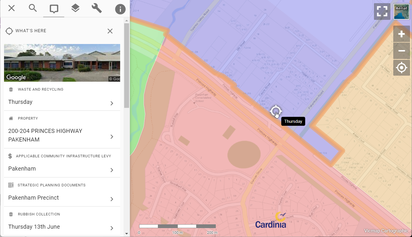
We've just rolled out a change to Pozi that makes it more intuitive for users to view information about map features and locations.
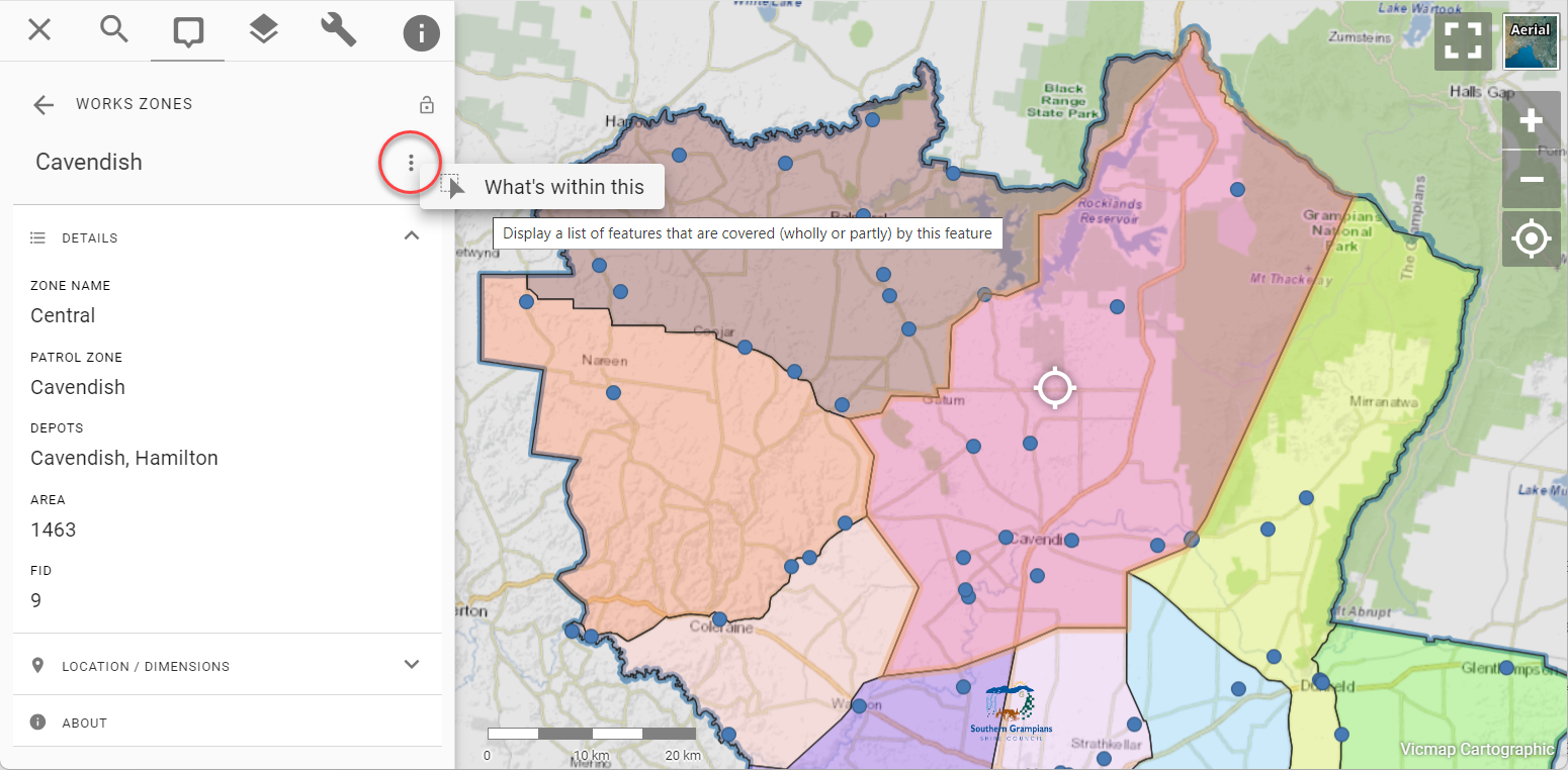
We've recently improved Pozi to make it easier for administrators to enable layers to be used in spatial intersection queries.
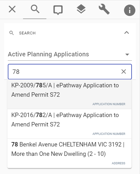
Pozi's search capabilities recently received a power boost. Pozi now enables users to search any vector layer.
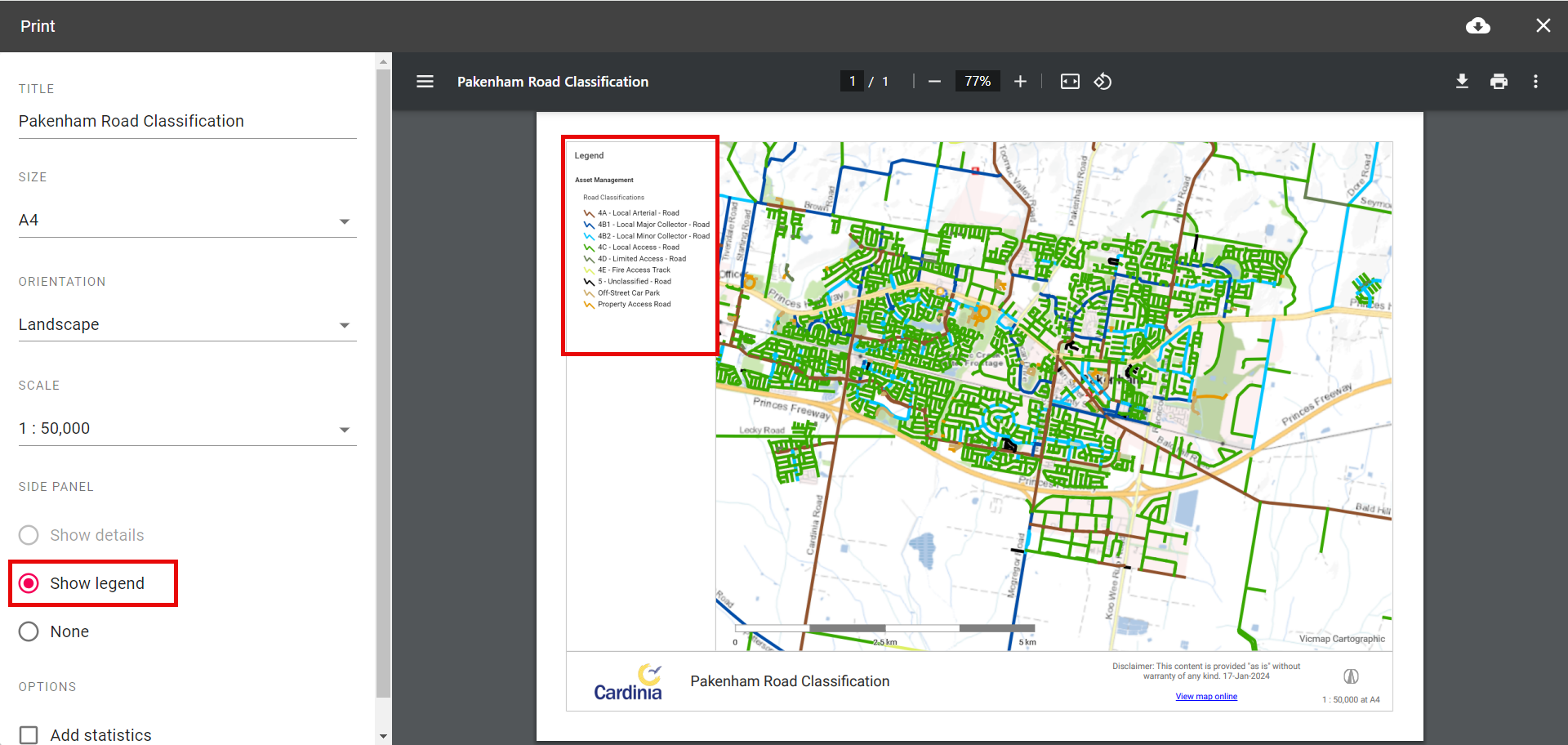
Print your maps with a detailed layer legend
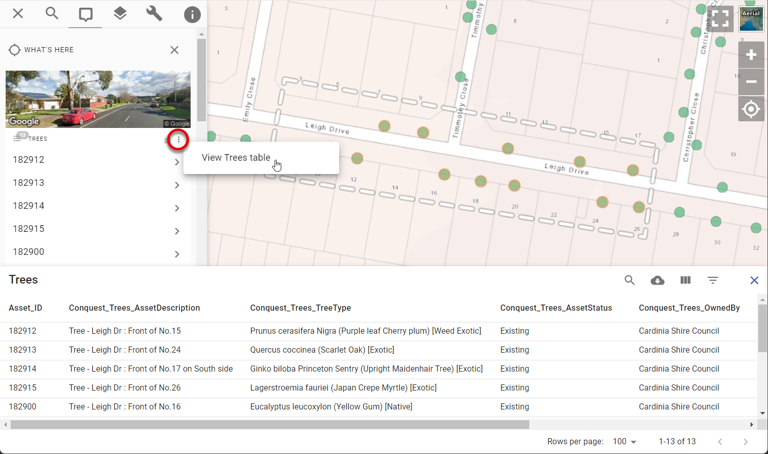
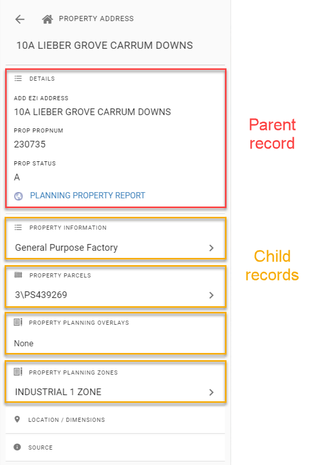
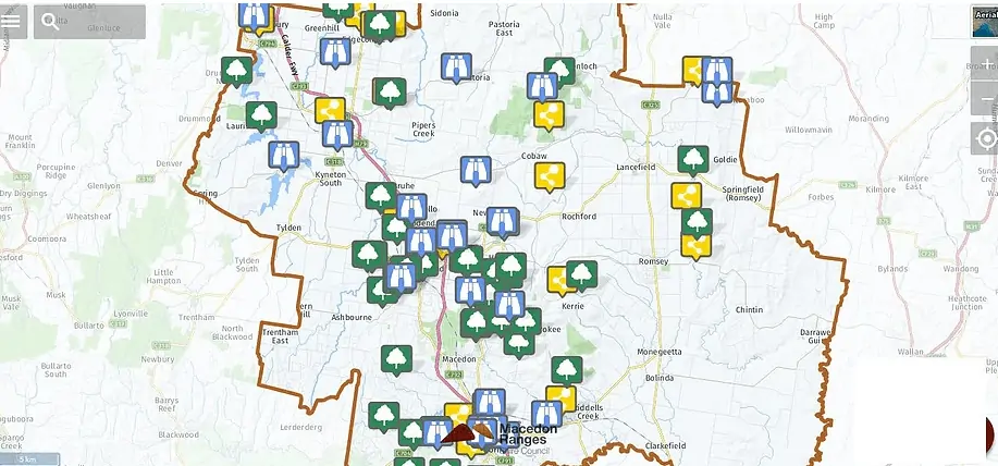
A new way to interact with your map layers

An announcement for users of Pozi Connect

What does it mean when one of your software vendors announces that your GIS needs to "move to the cloud"?

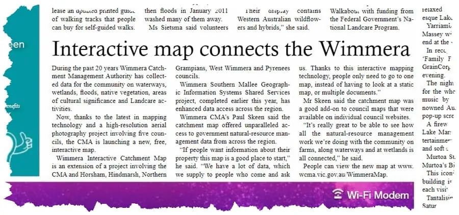
A vision to simplify the way Victorian councils integrate their property information into Vicmap
A try-before-you-buy approach to implementing a GIS metadata solution
An announcement for users of Pozi Connect.
An announcement for users of Pozi Connect.
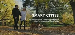
Smart Cities

Ensuring customer success is our number one priority. We provide the platform to ensure you can achieve your GIS goals.

Pozi makes gathering community feedback about specific locations a breeze!
We have previously discussed some creative ways organisations are integrating Pozi as part of customer service and community engagement.
Finding opportunities to get PR for your organisation can be incredibly difficult.
Traditionally Geographic Information Systems (GIS) have been a hidden resource of data portals used by organisation staff to deliver critical...
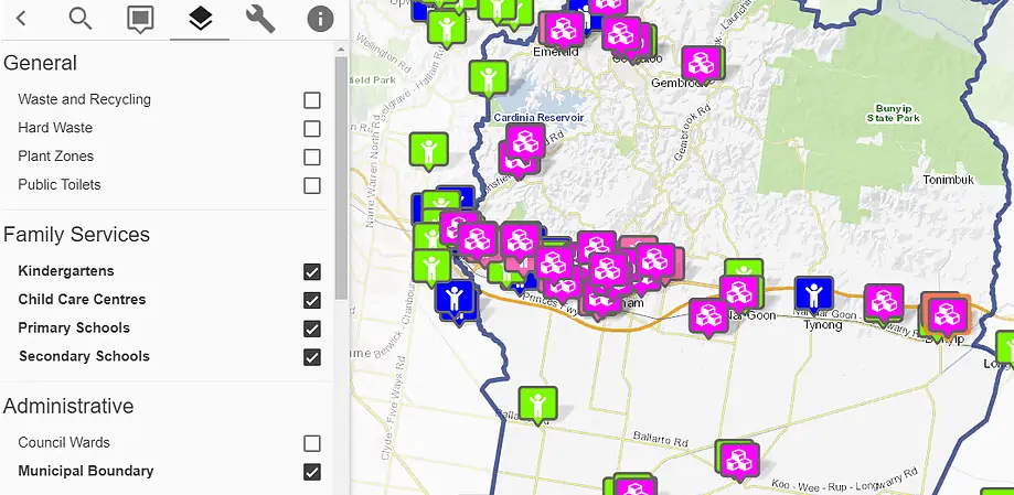
Pozi's web map helps Cardinia's Shire Council's customers easily find local services