#
Tag: cardinia shire council
See all tags.
Administrator Guide • Integrations
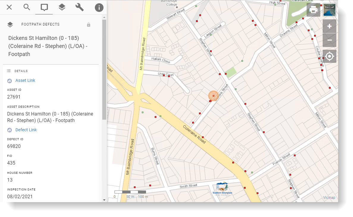
Conquest
GIS integration for Conquest Asset Management
Administrator Guide • Integrations
Nearmap
GIS integration for Nearmap
Administrator Guide • Integrations
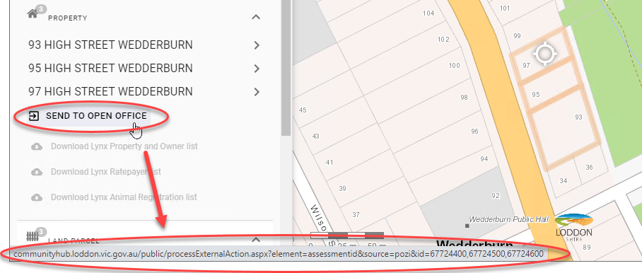
Open Office
GIS integration for Open Office
Blog
How web developers can use GIS data & Pozi
Traditionally Geographic Information Systems (GIS) have been a hidden resource of data portals used by organisation staff to deliver critical...
2018-01-29
Blog
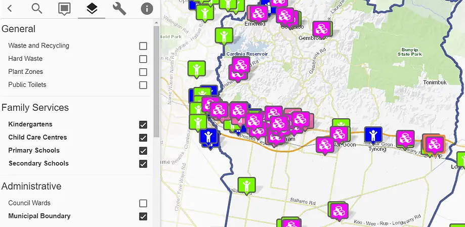
Cardinia Shire Council using GIS for customer service
Pozi's web map helps Cardinia's Shire Council's customers easily find local services
2017-10-31