#
Raster and Tile Layers
#
Web Map Service (WMS)
#
Services
#
DEECA Open Data Platform
#
data.gov.au
#
Pozi Cloud Server
#
Layer Type
For WMS datasets, the dataset type can be either TileWMS or ImageWMS.
TileWMS- loads the layer in a series of 640 x 640 image tiles. The tiles load incrementally in the map view, enabling the user to start to see the layer before the the entire map view is generated.ImageWMS- loads the layer as a single image that covers the current map view. In most scenarios it will be slower to load, but may be useful in avoiding unwanted duplication of any label text. (Note: there are currently differences between the way that Pozi loads TileWMS and ImageWMS layers that might result in degraded functionality for ImageWMS)
"type": "TileWMS"
#
Layer and Styling Configuration
{
  "title": "Public Land",
  "legend": "https://services.land.vic.gov.au/catalogue/publicproxy/guest/dv_geoserver/wms?request=GetLegendGraphic&version=1.0.0&format=image/gif&width=20&height=20&layer=CROWNLAND_PLM25",
  "group": "Administrative",
  "type": "TileWMS",
  "config": {
    "url": "https://services.land.vic.gov.au/catalogue/publicproxy/guest/dv_geoserver/wms",
    "params": {
      "LAYERS": "CROWNLAND_PLM25",
      "FORMAT": "image/GIF"
    }
  },
  "opacity": 0.5
}
{
"title": "Aerial Photo (2021 Jan)",
"group": "Imagery",
"type": "TileWMS",
"queryable": false,
"config": {
"url": "https://pozi-cardiniavicgovau.msappproxy.net/iis/MapServer?MAP=C:/Pozi/MapServer/maps/Aerial.map",
"params": {
"FORMAT": "image/jpeg",
"LAYERS": "NMD-1199_Cardinia"
}
},
"linkedLayers": [
"Vicmap Labels"
],
"localDataSource": true
}
#
Projection
Layers can be requested in any projection supported by the server by specifying the projection within the config element.
{
  "title": "Queensland Globe Imagery",
  "group": "Imagery",
  "type": "TileWMS",
  "showLegend": false,
  "config": {
    "url": "https://spatial-img.information.qld.gov.au/arcgis/services/Basemaps/LatestStateProgram_AllUsers/ImageServer/WMSServer",
    "projection": "EPSG:7856",
    "params": {
      "LAYERS": "LatestStateProgram_AllUsers"
    }
  }
}
#
Gutter
Sometimes a layer configured as a TileWMS layer can appear in Pozi with narrow white gaps between the tiles. Use the gutter parameter to specify an amount of padding to prevent gaps from showing.
{
  "title": "Nearmap - Dec 2023",
  "group": "Imagery",
  "type": "TileWMS",
  "config": {
    "gutter": 10,
    "params": {...
#
Other Parameters
Other parameters can be specified in the config element. See https://openlayers.org/en/latest/apidoc/module-ol_source_TileWMS.html for a list of available parameters.
Also, the LEGEND_OPTIONS can be overridden in parameters. This is particularly useful for the hideEmptyRules setting that can be used to suppress legend entries that are non-existent in a filtered dataset. Please see the section on
#
External SLD
WMS GetMap requests can be made with an sld parameter that contains the URL of an SLD file.
Note: as at 25 Feb 2022, the data.gov.au WMS service is not successfully responding to WMS requests that point to external SLDs. See 'Embedded SLD' below for an alternative styling configuration. Or better yet, consider using WFS if the dataset is small enough.
Note: the layer name is not specified in the config because it is specified within the SLD itself.
{
  "title": "Localities",
  "group": "Administrative",
  "type": "TileWMS",
  "config": {
    "url": "https://services.land.vic.gov.au/catalogue/publicproxy/guest/dv_geoserver/wms",
    "params": {
      "SLD": "http://files.pozi.com/config/sld/datavic-VMADMIN_LOCALITY_POLYGON-BENDIGO.sld",
      "FORMAT": "image/png8",
      "LAYER": "VMADMIN_LOCALITY_POLYGON"
    }
  }
}
When a SLD file defines the WMS layer using the NamedLayer setting, it is important that the LAYER parameter is also set in parameters. This has no affect on the GetMap call to the WMS service, however, it is required by Pozi to correctly choose the layer to be displayed in the legend by the GetLegendGraphics call.
#
Embedded SLD
WMS GetMap requests can be made with an sld_body parameter that contains the SLD styling rules as a string of XML.
{
  "title": "Park and Street Trees",
  "group": "Council Facilities and Services",
  "type": "TileWMS",
  "config": {
    "url": "https://data.gov.au/geoserver/wms",
    "params": {
      "SLD_BODY": "<?xml version='1.0' encoding='UTF-8'?><StyledLayerDescriptor xmlns='http://www.opengis.net/sld' xmlns:ogc='http://www.opengis.net/ogc' xmlns:xsi='http://www.w3.org/2001/XMLSchema-instance' version='1.1.0' xmlns:xlink='http://www.w3.org/1999/xlink' units='mm' xsi:schemaLocation='http://www.opengis.net/sld http://schemas.opengis.net/sld/1.1.0/StyledLayerDescriptor.xsd' xmlns:se='http://www.opengis.net/se'><NamedLayer><se:Name>ckan_ed15e3ea_48dc_47d2_afa6_518e6f5276e1</se:Name><UserStyle><se:Name>Glen Eira - Trees</se:Name><se:FeatureTypeStyle><se:Rule><se:Name>Single symbol</se:Name><se:PointSymbolizer><se:Graphic><se:Mark><se:WellKnownName>circle</se:WellKnownName><se:Fill><se:SvgParameter name='fill'>#33a02c</se:SvgParameter></se:Fill><se:Stroke><se:SvgParameter name='stroke'>#000000</se:SvgParameter></se:Stroke></se:Mark><se:Size>10</se:Size></se:Graphic></se:PointSymbolizer></se:Rule></se:FeatureTypeStyle></UserStyle></NamedLayer></StyledLayerDescriptor>"
    }
  }
}
#
Switching from external SLD to embedded SLD:
- open SLD in text editor (VSCode or NotePad++ recommended)
- ensure
<NamedLayer><se:Name>is populated with the name that the server uses to identify the layer (eg the ckan id in data.gov.au) - ensure any field names that specified in
<ogc:PropertyName>settings match the case expected by the server (eg must be lower case for data.gov.au) - find and replace double quotes with single quotes
- find and replace double spaces with blank
- find and replace line returns (use
\nin 'Extended' search mode in Notepad++) with blank
The resulting text is a single line of XML.
In the dataset config, replace the existing sld parameter with a new sld_body parameter, using the line of XML as the value.
Example configurations:
- Glen Eira Street Trees
- Mitchell Contours
- Southern Grampians Waste Water Land Capability Hazard Classification
#
CQL Filter
{
  "title": "Public Land - Council Committee of Management",
  "group": "Administrative",
  "type": "TileWMS",
  "config": {
    "url": "https://opendata.maps.vic.gov.au/geoserver/wms",
    "params": {
      "LAYERS": "plm25",
      "CQL_FILTER": "strToUpperCase(mng_group)='COM COUNCIL'",
      "LEGEND_OPTIONS": "fontAntiAliasing:true;hideEmptyRules:true"
    }
  }
}
The LEGEND_OPTIONS parameter may need to be overridden in cases like this where the rule will reduce the number of entries in the legend. The hideEmptyRules setting can be used to supress legend values that aren't available due to the filter. Note: this setting can make the legend significantly slower to load in a large dataset.
#
Selectability
Individually configured WMS layers (ie, not configured in a QGIS project) are not selectable/queryable by default. (However there is a plan to change Pozi's default behaviour for WMS layers.)
To make WMS layers selectable, add "parent": "Whats Here" to the layer's configuration.
"parent": "Whats Here",Also, if a WMS layer doesn't have a specified style, it may need an additional query_layers parameter to enable Pozi to fetch attributes for the layer.
{
  "title": "Waste Water Land Capability Hazard Classification",
  "group": "Land Capability",
  "type": "TileWMS",
  "parent": "Whats Here",
  "config": {
    "url": "https://data.gov.au/geoserver/wms",
    "params": {
      "layers": "ckan_088d79af_df5a_4bfe_87ce_6c7236a8216c",
      "query_layers": "ckan_088d79af_df5a_4bfe_87ce_6c7236a8216c"
    }
  }
}
#
Imagery
Any layer configured with "group": "Imagery" will appear in the 'Imagery' layer group (as expected). Layers within this special group are displayed with a radio button to toggle between layers instead of the standard tick boxes.
The topmost imagery layer can be toggled by the Aerial button at the top right of the Pozi map.
#
Imagery Tile Services
{
  "title": "HERE Satellite",
  "group": "Aerial",
  "type": "XYZ",
  "about": {
    "organisation": "HERE Technologies",
    "url": "https://developer.here.com/documentation/map-tile/topics/what-is.html"
  },
  "config": {
    "maxZoom": 20,
    "url": "https://{1-4}.aerial.maps.api.here.com/maptile/2.1/maptile/newest/hybrid.day/{z}/{x}/{y}/256/png8?lg=ENG&app_id=ourappid&token=ourtoken"
  }
}
{
"title": "ArcGIS World Imagery",
"group": "Imagery",
"type": "XYZ",
"config": {
"maxZoom": 18,
"url": "https://server.arcgisonline.com/ArcGIS/rest/services/World_Imagery/MapServer/tile/{z}/{y}/{x}"
}
}Nearmap imagery configuration makes use of the maxZoom and extent parameters to limit the imagery that Pozi requests when it is necessary to comply with the Nearmap terms of service for public use.
{
  "title": "Nearmap - Oct 2023",
  "group": "Imagery",
  "type": "XYZ",
  "linkedLayers": [
    "Vicmap Labels"
  ],
  "config": {
    "maxZoom": 20,
    "url": "https://geoproxy.pozi.com/https://au{0-3}.nearmap.com/maps?x={x}&y={y}&z={z}&nml=v&version=2&httpauth=false&authkey=nearmap-bendigo-2023-10-20"
  },
  "extent": [
    144,
    -37.07,
    144.86,
    -36.37
  ]
}
#
DEECA Image Web Server
- About
- Report outages: gis.helpdesk@delwp.vic.gov.au
- Other support requests: coordinated.imagery@delwp.vic.gov.au
#
GetCapabilities
https://iws.maps.vic.gov.au/erdas-iws/ogc/wms/RDP?SERVICE=WMS&REQUEST=GetCapabilities
The current GetCapabilities is over 10MB in one long line. Save it to a text file and use https://stackoverflow.com/questions/3961217/how-do-i-format-xml-in-notepad to format the text into a readable form.
#
Example Configuration
{
  "title": "Aerial 2019",
  "group": "Imagery",
  "type": "TileWMSAuth",
  "about": {
    "source": "Victorian Coordinated Imagery Program",
    "organisation": "DELWP",
    "date": "Feb 2019",
    "url": "https://www2.delwp.vic.gov.au/maps/maps-and-services/coordinated-imagery-program"
  },
  "linkedLayers": [
    "Vicmap Labels"
  ],
  "config": {
    "url": "https://imageproxy.pozi.com/https://iws.maps.vic.gov.au/erdas-iws/ogc/wms/RDP",
    "params": {
      "LAYERS": "VMIMAGERY_loddon_2019feb20_air_vis_10cm_mga54.ecw",
      "STYLES": "",
      "TILED": true,
      "FORMAT": "image/webp",
      "authkey": "datashare-loddon"
    }
  }
}
Note: each layer name in the LAYERS parameter is separated by a comma, and the STYLES parameter must contain the same number of commas.
{
  "title": "Aerial Photo Mosaic 2015-2020",
  "group": "Imagery",
  "type": "TileWMSAuth",
  "about": {
    "source": "Victorian Coordinated Imagery Program",
    "organisation": "DELWP",
    "url": "https://www2.delwp.vic.gov.au/maps/maps-and-services/coordinated-imagery-program"
  },
  "linkedLayers": [
    "Vicmap Labels"
  ],
  "config": {
    "url": "https://imageproxy.pozi.com/https://images.land.vic.gov.au/ecwp/ecw_wms.dll",
    "params": {
      "LAYERS": "VMIMAGERY_mallee_2015jan02_air_vis_20cm_mga54,VMIMAGERY_wimmera-grampians_2020dec20_air_vis_15cm_mga54.ecw",
      "STYLES": ",",
      "TILED": true,
      "authkey": "datashare-yarriambiack",
      "format": "image/webp"
    }
  }
}
#
Queensland Globe Imagery
{
  "title": "Queensland Globe Imagery",
  "group": "Imagery",
  "type": "XYZ",
  "about": {
    "organisation": "Queensland Globe",
    "url": "https://qldglobe.information.qld.gov.au/"
  },
  "config": {
    "maxZoom": 20,
    "url": "https://spatial-img.information.qld.gov.au/arcgis/rest/services/Basemaps/LatestStateProgram_AllUsers/ImageServer/tile/{z}/{y}/{x}?blankTile=false&browserCache=Map"
  }
}
{
"title": "Queensland Globe Imagery",
"group": "Imagery",
"type": "TileWMS",
"showLegend": false,
"config": {
"url": "https://imageproxy.pozi.com/https://auth-spatial-img.information.qld.gov.au/arcgis/services/Basemaps/LatestStateProgram_QGovSISPUsers/ImageServer/WMSServer",
"projection": "EPSG:7856",
"params": {
"LAYERS": "LatestStateProgram_QGovSISPUsers",
"format": "image/jpeg",
"authkey": "xxxx"
}
}
}
#
Basemaps Tiles
Any layer configured with "group": "Basemap" will appear in the 'Basemap' layer group (as expected). Layers within this special group are displayed with a radio button to toggle between layers instead of the standard tick boxes.
The topmost layer in the 'Basemap' group will be the default basemap displayed in Pozi.
#
Sources
#
Raster Tiles
{
  "title": "OpenStreetMap",
  "group": "Basemap",
  "type": "XYZ",
  "about": {
    "organisation": "OpenStreetMap",
    "url": "https://www.openstreetmap.org/about"
  },
  "config": {
    "maxZoom": 20,
    "url": "https://{a-c}.tile.openstreetmap.org/{z}/{x}/{y}.png"
  }
}
Other OpenStreetMap layers are available at https://wiki.openstreetmap.org/wiki/Tile_servers.
{
  "title": "HERE Map",
  "group": "Basemap",
  "type": "XYZ",
  "about": {
    "organisation": "HERE Technologies",
    "url": "https://developer.here.com/documentation/map-tile/topics/what-is.html"
  },
  "config": {
    "maxZoom": 20,
    "url": "https://{1-4}.base.maps.api.here.com/maptile/2.1/maptile/newest/normal.day/{z}/{x}/{y}/256/png8?lg=ENG&app_id=ourappid&token=ourtoken"
  }
}
{
"title": "Google Maps",
"group": "Basemap",
"type": "GoogleMaps",
"config": {
"google": {
"key": "insert client's Google Maps API key here"
}
}
}{
"title": "Vicmap",
"group": "Basemap",
"type": "XYZ",
"visible": true,
"about": {
"source": "Vicmap Maps and Services",
"organisation": "DELWP",
"url": "https://www.land.vic.gov.au/maps-and-spatial/data-services/vicmap-basemap/licensing-and-copyright"
},
"config": {
"url": "https://base.maps.vic.gov.au/wmts/CARTO_WM_256/EPSG:3857:256/{z}/{x}/{y}.png"
}
}https://base.maps.vic.gov.au/service?SERVICE=WMTS&REQUEST=Getcapabilities
Pozi is not currently licensed for Mapscape. This configuration is for evaluation purposes only.
{
  "title": "Mapscape",
  "group": "Basemap",
  "type": "XYZ",
  "about": {
    "organisation": "Spatial Vision",
    "url": "https://spatialvision.com.au/mapscape/"
  },
  "config": {
    "maxZoom": 18,
    "url": "https://proxy.pozi.com/https://mapscape.maps.em.vic.gov.au/color/{z}/{x}/{y}.png"
  }
}
{
"title": "Queensland Globe Lite",
"group": "Basemap",
"type": "XYZ",
"config": {
"maxZoom": 19,
"url": "https://spatial-gis.information.qld.gov.au/arcgis/rest/services/Basemaps/QldMap_Lite/MapServer/tile/{z}/{y}/{x}?blankTile=false&browserCache=Map"
}
}Basemaps are available in QldMap_Lite, QldBase_Pastel and other variations: https://spatial-gis.information.qld.gov.au/arcgis/rest/services/Basemaps/.
#
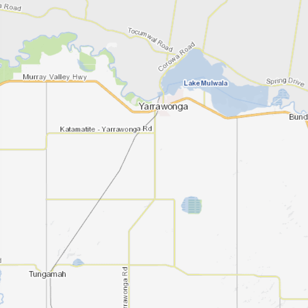
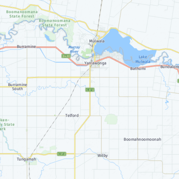
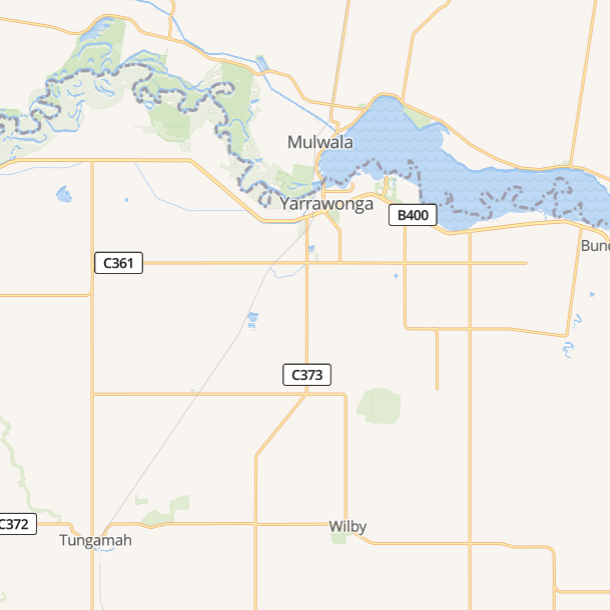
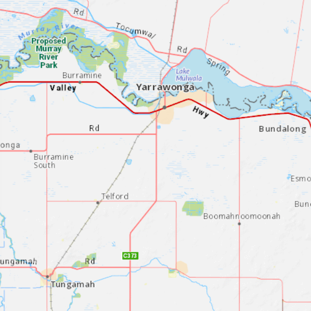
Comparison
#
HERE
#
Mapbox
#
Mapscape
#
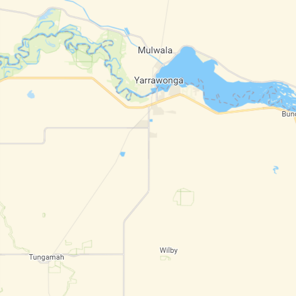
MapTiler
#
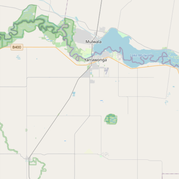
OpenStreetMap
#
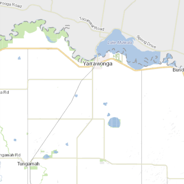
Vicmap
#
Vicmap Legacy
