#
#
Pozi Features
Pozi is a customisable, user-friendly geospatial system to visually communicate your organisation's location-based information.
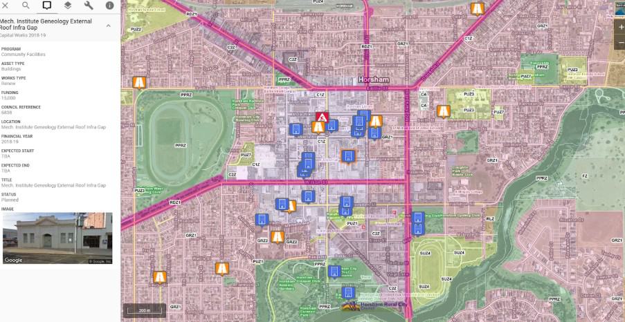
All Pozi subscriptions include:
- customised web map application
- high performance hosting
- unlimited users
- custom subdomain
- embeddable maps
- custom branding
- updates and bug fixes
- configuration updates
- helpdesk support
#
Pozi Public
#
Authoritative, responsive & well supported
Live, authoritative data
Customer support
Responsive design
Pozi connects to GIS data at its source to deliver your online map with the most accurate, up-to-date information possible; also eliminating the hassle of maintaining local copies of external datasets.
Receive personalised assistance by phone or email from the Pozi team in Melbourne, Australia -- the people who administer and develop the Pozi platform.
Pozi maps are fully responsive to fit on any device. Whether your customers are searching information on a desktop, tablet or phone, Pozi intelligently arranges its interface to make best use of the available screen size.
#
Intelligent with pinpoint GPS accuracy
Intelligent address search
GPS location
Aerial imagery
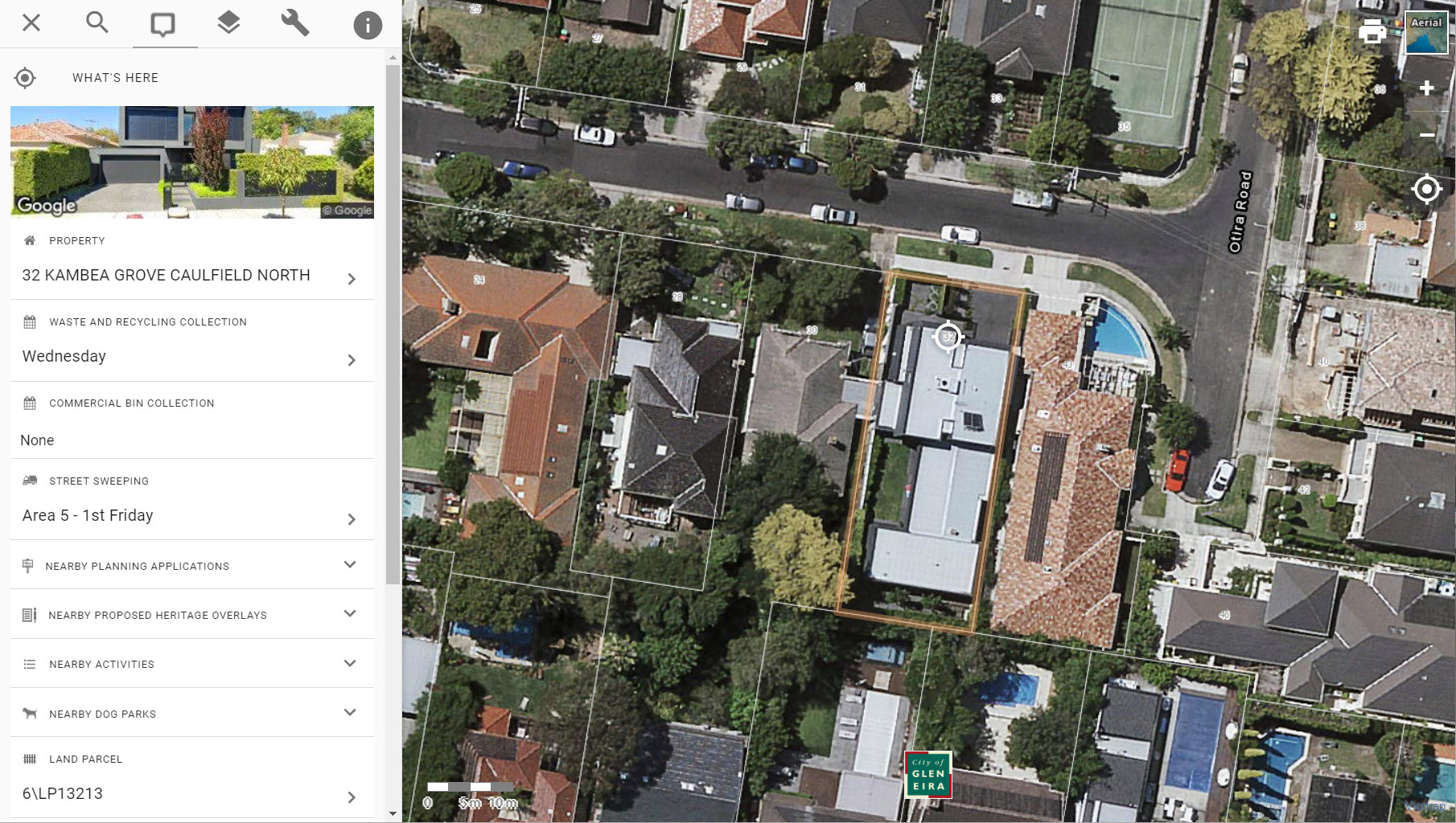
Pozi's autocomplete address search rapidly returns results specific to an address and the map's region. The Pozi search box intelligently parses customers' requests to get to an address with a minimum of keystrokes and fuss.
Users easily centre the map by pressing the GPS button, and Pozi uses their device's GPS to pinpoint their location on the map.
Aerial imagery allows users to clearly see the visual landmarks of their location including buildings, roads and vegetation. With a single click, customers can toggle on or off an aerial photo layer.
#
Unlimited users, zero install & custom maps
Unlimited users
Zero installation
Custom maps
Want to share your organisation's data with a wider audience? Pozi scales to serve any number of users. The team at Pozi will take care of your website infrastructure, so you can concentrate on your business.
Users don't need to install any specialty software to use Pozi. The online map is accessible on any device.
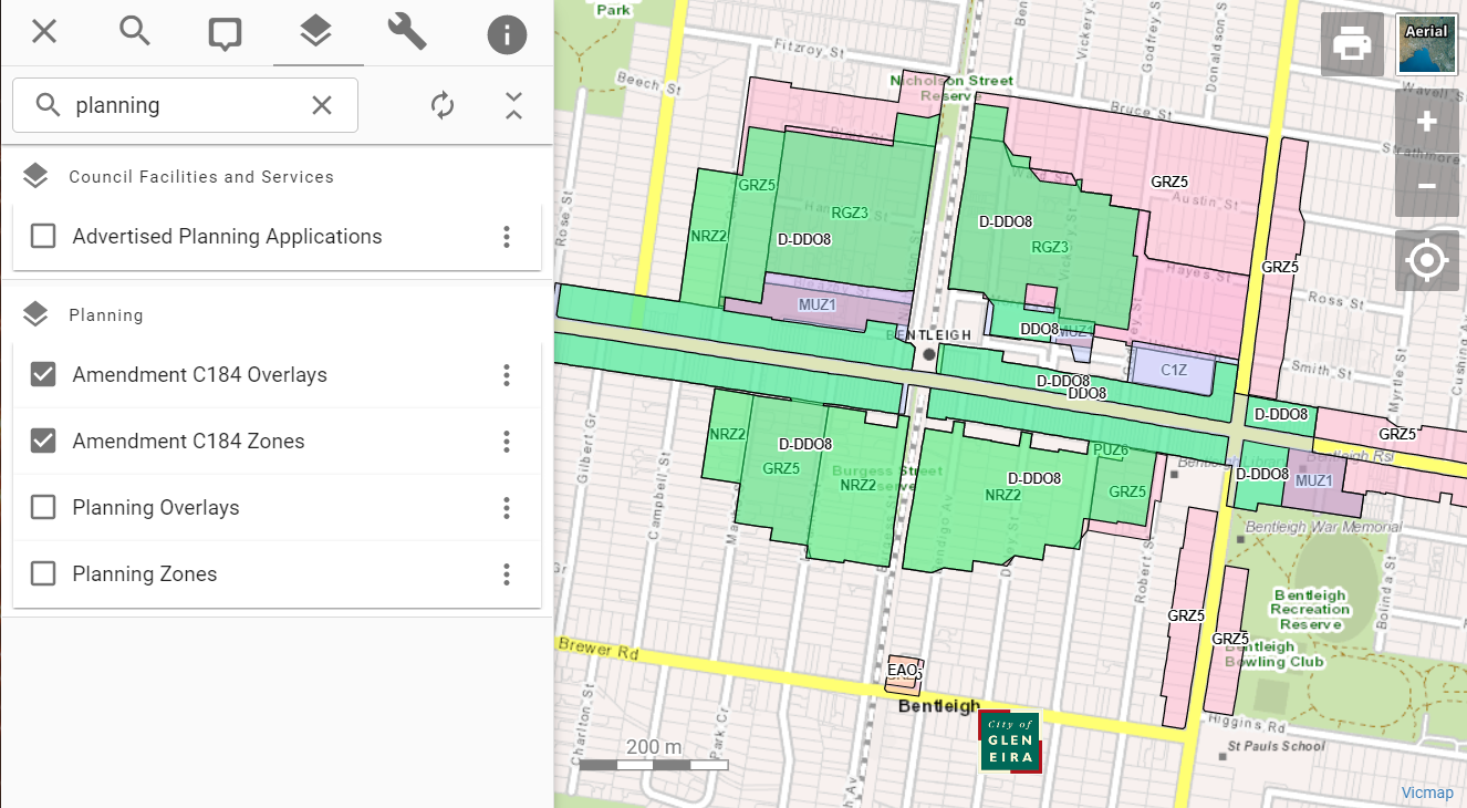
Pozi allows you to have unlimited, embeddable and bookmarkable maps customised to your organisation's data.
#
Pozi Pro
Pozi Pro offers your organisation all the above features along with more advanced functionality to further engage with customers and satisfy the demands of internal staff and other repeat users.
Community engagement
Advanced search
Nearby places
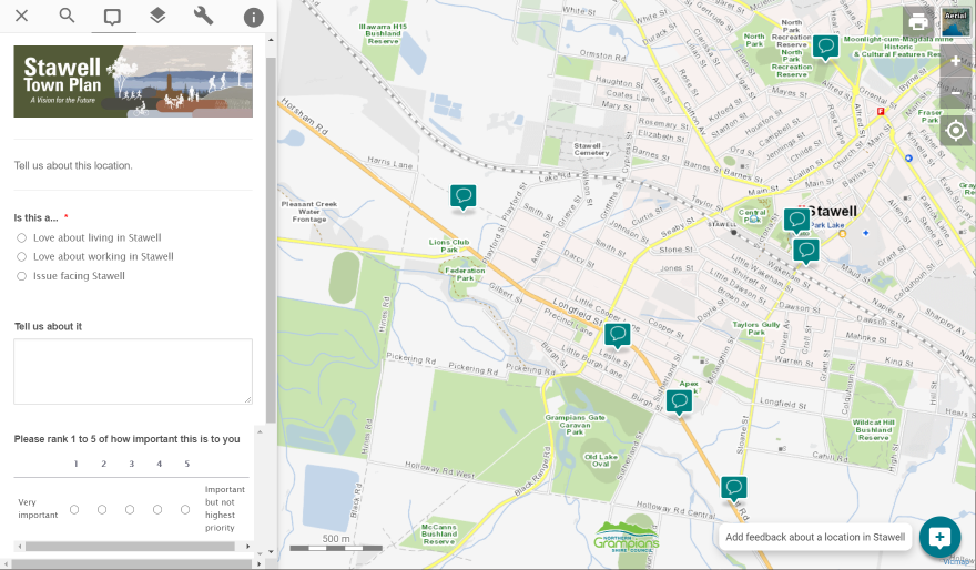
Pozi Pro is your two-way communications channel with integrated forms enabling your community to provide feedback, fill in surveys, book facilities, post events, or report issues about user-selected locations.
With Pozi Pro, users can search for a location using information other than an address, such as a facility name, property id, asset id and more.
Whenever a user searches for their address or location, Pozi Pro shows the nearest facilities and services to that address, helping users quickly get their bearings.
#
Multiple imagery layers, plus widgets
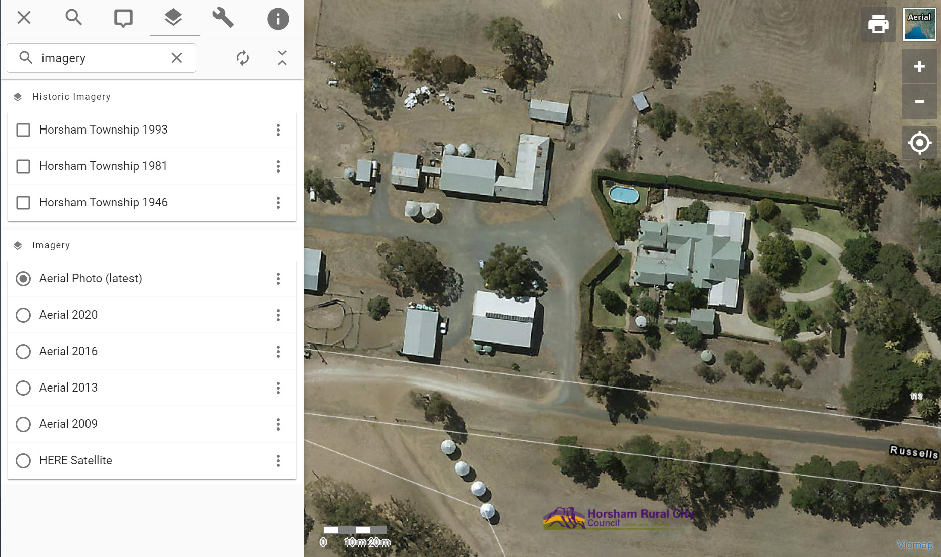
Multiple imagery layers
Map widget
Data widget
Enable users to pick between multiple images to compare by date for monitoring urban growth, building footprints, vegetation and more. Pozi Pro can also merge imagery from multiple captures into a seamless layer for complete coverage.
Pozi Pro's map widget allows you to embed an address search box on your website to launch a custom map. Users simply enter an address and Pozi Pro will launch its map featuring their chosen location.
The data widget is an address search box embedded on your website that directly displays location-specific information (without a map launch), such as council bin collection dates.
#
Filtering, GPS tracking and bookmarks
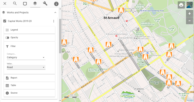
Layer filter & mulit-select
GPS tracking
Custom bookmarking
Layer filtering allows users to pick the subset of visual data and detail specifically what you would like viewable on a map. Users can select multiple properties in Pozi Pro by defining areas of interest.
Pozi Pro has optional constant GPS tracking that follows users as they walk or drive, allowing easy identification of assets and other roadside features as they travel.
Pozi Pro can generate custom map links to control exactly how the app appears to users. Focus your users' attention on what you want them to see, hiding unneeded datasets and buttons. Especially helpful for customer service and emailing map information specific to the customer.
#
Pozi Enterprise Cloud
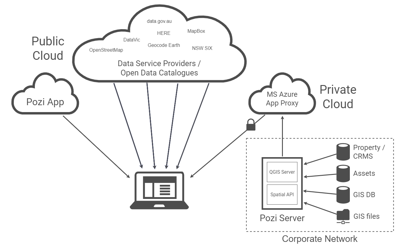
Take your organisational data and public web page to the next level. Ultimate integration with your organisation's cloud infrastructure, with Azure AD Application Proxy integration. Pozi Enterprise Cloud has all the features of Pozi and Pozi Pro plus the following.
Property system integration
Asset system integration
GIS integration
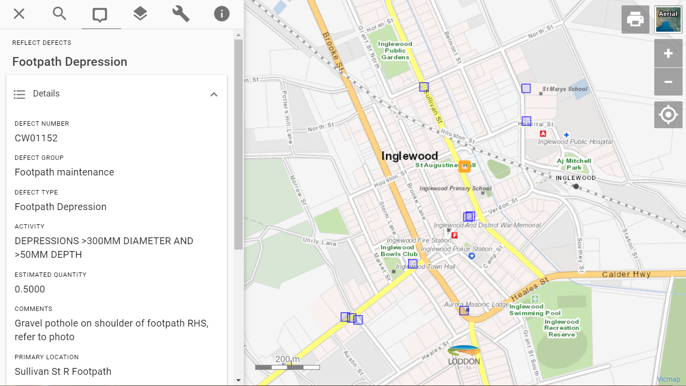
Pozi Enterprise enables internal staff to access property information from your organisation's internal property database, such as owner and ratepayer details, planning, local law permits, animal registrations waste, special charges, and compliance issues.
With Pozi Enterprise, staff will see live data for asset status, as well as inspection and maintenance history.
Enable staff to access map layers directly from your organisation's network, including: MapInfo TAB, Esri Shapefile, PostGIS, SQL Server Spatial, GeoPackage, and any other GDAL-compatible source (SQLite, DXF, CSV, XLSX, VRT and more).
#
Feature Round-Up
- Search: search across your datasets in a simple autocomplete search box
- Table View: view, filter and search layer features in an interactive table view that's synchronised to the map
- Layer Search: easily find map layers by typing in the layer search box to reveal layers that match the layer name, group name or associated metadata
- Print: generate print-ready PDFs with organisation logo in various page sizes and orientations; optionally add a report with statistics of features within the current map view
- Metadata: view information about layers, including source and description
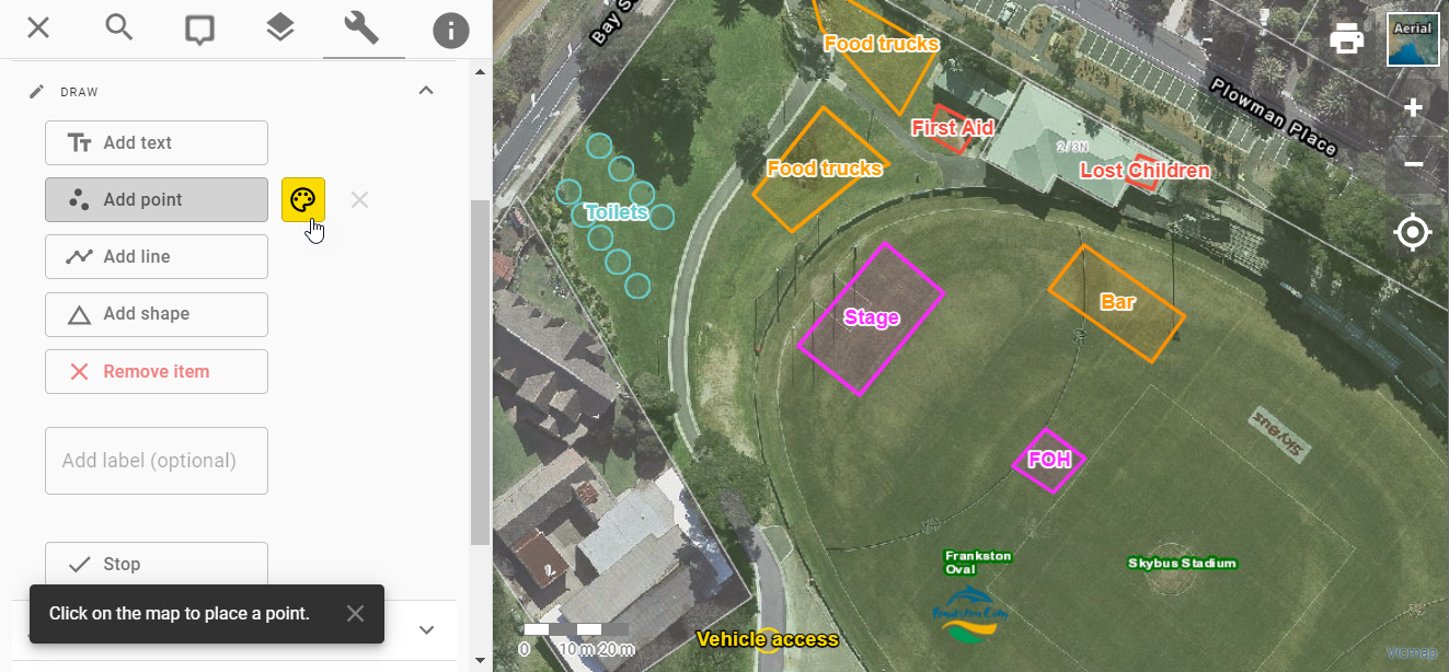
- Annotation: mark up a map with points, lines, shapes and text, and easily share the marked-up map with others
- Measure: obtain distance and area measurements using the interactive measuring tools, or view dimensions for any selected feature
- Select: identify features at any location or within a region using point and area selection modes
- Share: customise a map with specific layers and location, and generate a link to share with others or bookmark for later use
- Information: view feature attributes, linked documents, web links, media previews and related attributes from other non-spatial sources; no pre-processing, joining or data duplication required
- Export data: download CSVs of selected features and linked data (eg, download a list of property owner details from selected properties for a mail merge)
- Export map: download geo-referenced map images for use in desktop GIS or presentations
- Progressive Web App: add Pozi to the home screen of any device or desktop and launch it and switch between it and other apps as if it were a native application
- Community Consultation: collect community feedback about user-selected locations or pre-defined map features
- Web API: launch Pozi from other applications, controlling aspects like zooming to a specific property and adding map layers
- Web Widgets: embed address search widgets in web pages to launch a map or display location-specific information
- Publisher: sync internal datasets to the Pozi cloud for publishing to the public and other external stakeholders
#
Get in touch
Contact us for a friendly chat about how we can work with you to deliver your organisation's needs.
